
Introducing the eBird Hotspot Explorer!

For the first time birders can explore eBird’s site information in a map-based tool designed to provide quick access to the information they need. Discover the best places for birding nearby or around the world. The Hotspot Explorer provides a completely new way to plan birding trips, putting millions of records from over 100,000 eBirders around the world into your hands. At a glance, you can see which birding locations have the most species. You can filter to show only the results for a particular month, or for the last 10 years, or sites with visits during the last month. The hotspot explorer may even help reveal some hidden gems near you that you never knew about!
When you first arrive at the map, you see a broad grid representing species diversity. The hottest areas are bright red. Click on any grid cell to see the diversity value. Zoom in to see finer grid cells, and zoom in further to view individual hotspots (also coded by diversity). You can restrict month/year range at the top of the page to refine what information the Hotspot Explorer returns. NOTE: The grid cells show overall diversity for that grid cell, including personal locations (not the diversity at hotspots); it is possible to have a grid cell with 100 species but no hotspots.

North American bird diversity as shown in the initial view of the eBird Hotspot Explorer.
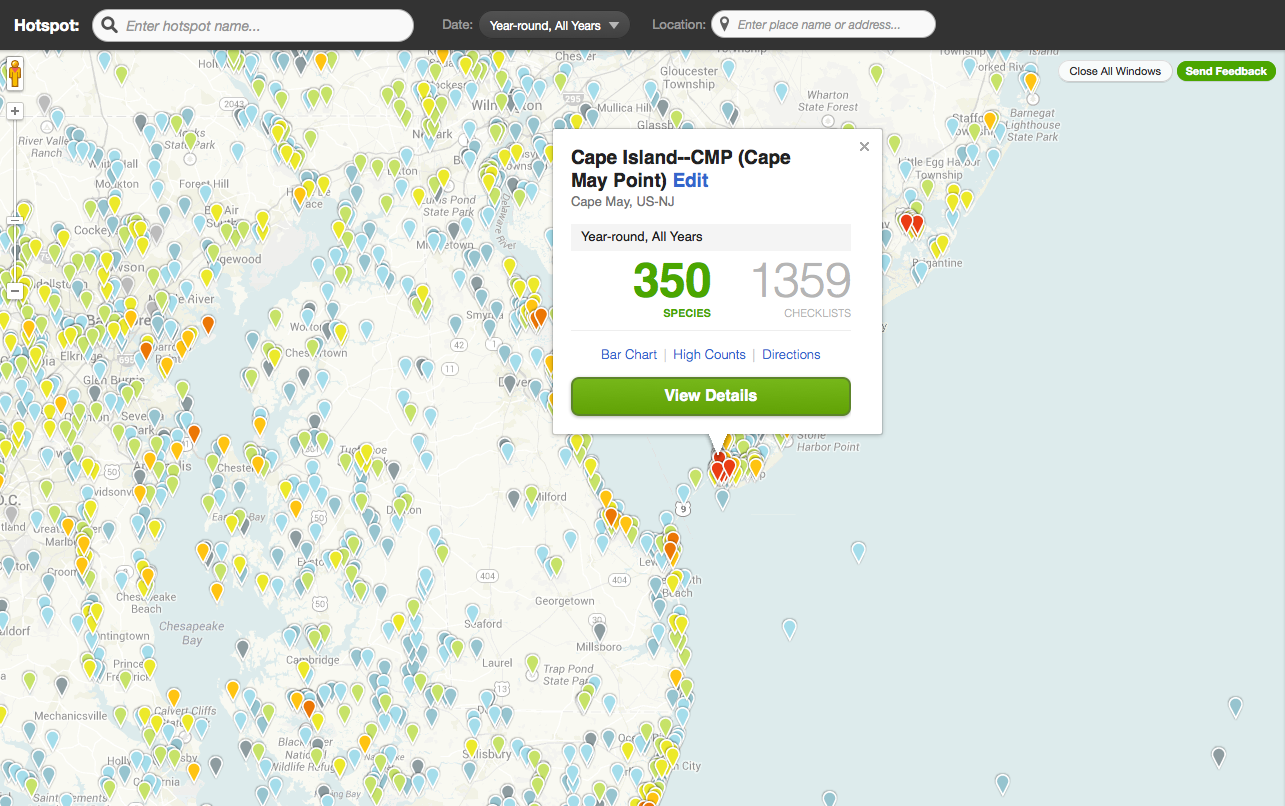
Hotspot Explorer view of the Mid-Atlantic region. Note the bright red at the tip of Cape May Point, NJ. Click on any hotspot to get details about how many birds have been seen there, as well as how many checklists have been submitted.

Hotspot Explorer details page for the “Hawkwatch Platform” at Cape May.