On this Page:
Welcome to the NC Bird Atlas!
The Atlas is a 5-year effort to map the location and breeding status of birds throughout North Carolina. We began the project in 2021 and currently plan on wrapping up data collection in 2026.
Subscribe for News
Sign up to keep up with important Atlas information like upcoming events and updated Atlas protocols. We will be judicious about sending out email and keep it confined to key information. As always, this site will have the most up-to-date information.
Sign Up for eBird
You will have to sign up to contribute to the NC Bird Atlas. If you are new to eBird, check out these resources to get familiar.
Sign up for eBird here
Use the Atlas Portal
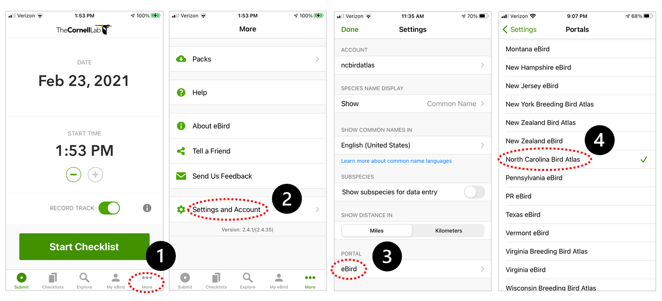
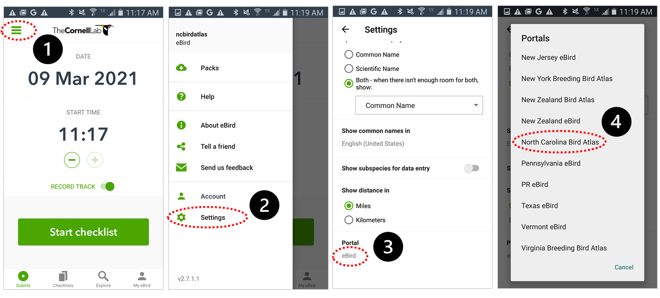
Once you have created an account and installed the eBird app, you can set your data to be logged in the NC Bird Atlas portal using the following steps.
iOS
Android

Where to go?
While we will accept observations from anywhere in North Carolina, we prefer data from priority blocks. These blocks are spread throughout the state to help us get a better sampling of all kinds of habitat in the state.
View blocks in our Priority Block Interactive Map or Google Maps with Priority Block Boundaries
How to Atlas
Everyone can participate in the Atlas, and it is up to you to determine how much you would like to contribute! Access our handbook and other materials to help guide you here.
How Much Do You Want to Atlas?
| A Little | A Little More | A Lot |
|
|
|
Breeding Codes: Possible, Probable, or Confirmed?
This is the fun part of Atlasing! By recording behaviors on your checklists you provide critical data for science and conservation. Behaviors are split into 4 categories: Observed, Possible, Probable, and Confirmed. Like other observations, you will have to log these behavior codes in eBird. Check this page for instructions.
- Learn more about using these on our Understanding Breeding Codes page.
When Is a Priority Block Completed?
The NC Bird Atlas focuses on priority blocks, spreading out birding effort across the state. When a block has had enough effort, we mark it as complete to encourage Atlasers to focus on other priority blocks. The goal is to have adequate coverage of all priority blocks by the end of the project!
Because blocks cover the entire breadth of the diversity of landscapes in North Carolina, the NCBA Team and regional coordinator will review data from each block to determine if a block is completed. Please consult your regional coordinator if you think a block is complete.


