Red-billed Tropicbird—a potential prize for hurricane birding.
The landfall of tropical low pressure systems–whether hurricanes or their weaker cousins tropical storms and tropical depressions–is more often a North American phenomenon than a European one. Birders in the USA and Canada are increasingly well-prepared for the seabird bounty that these storms can bring. While these storms can be devastating from human and societal perspectives, they can be positively thrilling for the birder that finds a safe and dry place to observe the action during and after the passage of the storm. As we write, Tropical Storm Joaquin is churning across the Atlantic and is currently forecast to make landfall (or to affect land as its circulation gets very close to shore) in western Europe as either a Tropical Depression (winds up to 64 kph) or a Tropical Storm (winds of 64-117 kph). Although Joaquin is weakening as it approaches Europe, European birders should take note because of the very fact of a storm crossing the Atlantic as a Tropical Storm is a rare event and should begin planning now to observe the avian effects of the storm.
Europe has previously received effects of dissociated tropical systems, but it is rare that a tropical system maintains its intensity sufficiently to retain the title of a Hurricane or Tropical Storm. Although the exact area of landfall remains uncertain, portions of the Iberian Peninsula at present have the highest likelihood for the storm’s arrival in Europe. This would be similar, in terms of landfall, to the arrival of perhaps the only previous tropical system to arrive in Europe as a tropical system — Hurricane Vince in October 2005. Joaquin’s circulation will remain intact even as it deteriorates into a Tropical Depression and there is a high probability that it will entrain some spectacular rarities from the Nearctic. Below is a guide to birding in the storm and some predictions about what to expect. This guide may be particularly relevant to those of you in the vicinity of the Azores and in Iberian Peninsula. There has already been a rare bird in the Canary Islands, probably not due to Joaquin, but a result of strong low pressure systems’ passages across the Atlantic —Spain’s second Bobolink!
Birding in a hurricane or Tropical Storm–when done safely–can provide some of the most exciting birding a birder will ever experience. Rarities can become the expected and some birds or spectacles may be once-in-a-lifetime opportunities. It also is a great time for those interested in coming up with their own plan and finding their own birds. Since many birds disperse quickly after a storm, hurricane birding does not favor the twitcher, who rarely can arrive in time to catch a given rarity. Making a plan, and having it pan out, only adds to the reward.
There are a couple plans to consider: 1) coastal or coastal bay seawatching; 2) inland lakes, reservoirs, and rivers. If winds remain strong, birding inland sites may be just as exciting as coastal ones. Read on below for more information.
Our advice is to make your plan now and adjust up until the arrival of the storm. Once you have picked your spot, commit to it and have faith that your plan will produce with patience. In North America, it has often taken a lot of patience to be rewarded with rare birds–this list and this list for example were the rewards of a full-day watch that began at 9am (with hourly lists documenting the arrival and passage of the storm.) However, as the storm passes and the winds shift, you may well want to relocate to a site more well-situated to winds from a different direction. For example, if you are on the south side of a peninsula as the storm approaches with southerly winds in your face, you may want to switch to the north side as the storm passes, to keep the winds in your face (and ensure that seabirds are pinned along the shoreline).
If you bird globally–and keep your records in eBird–please be sure to enter them promptly so that the best information on the storm and its birds can reach others. If you don’t use eBird, now would be a great time to start by entering your records from this historic Tropical Storm Joaquin.
TRACKING THE STORM
A few good sites to watch for the latest predictions and news are:
Weather Online: Tropical Storm Joaquin.
Weather Underground – Predicted storm track
RARITIES TO WATCH FOR
What to expect from a storm that crosses the Atlantic with its circulation intact is a challenge to predict. There is not much precedent, so some fascinating questions will be answered by the intrepid (and careful!) birders that go birding in this storm. Among them:
- How will the avian load of a trans-Atlantic storm compare? What birds are seen after hurricanes depend on the storm’s track, strength, path, and speed. The behavior of the birds are also a factor, with more aerial species more apt to become entrained. Some birds may become entrained but simply cannot survive aloft in the wind field for a very long time. Joaquin formed in late September (around 29 September) in the Bahamas and did not move substantially northwards until 3 October. It hit Bermuda 5 October and is forecast to make European landfall 4 or 5 days later. Can tropical seabirds remain with the storm that long? Those that do make it may well be quite hungry and weakened, so may be easier for birders to find and might hang around longer. Will its passage over relatively depauperate waters allow storm-blown birds to “drop out” or will they remain with the storm?
- Sooty Terns – Will this quintessential hurricane bird get deposited in the Europe for an historic landfall?

Sooty Tern—the classic hurricane bird, this one displaced by Tropical Storm Hanna
- What of Bridled Tern? – In the United States, Sooty Tern tends predominate in hurricanes, and unfailingly is the one more likely to get deposited inland. When Bridled occurs it tends to be able to better resist transport inland, and instead turns up coastally in bays, seawatches, or as weakened or moribund birds on beaches. If Bridleds occur, will the pattern hold? Or, since Bridled Tern occurs farther north (regularly to Massachusetts in late summer), will it be proportionally more prevalent than the more southerly Sooty Tern?
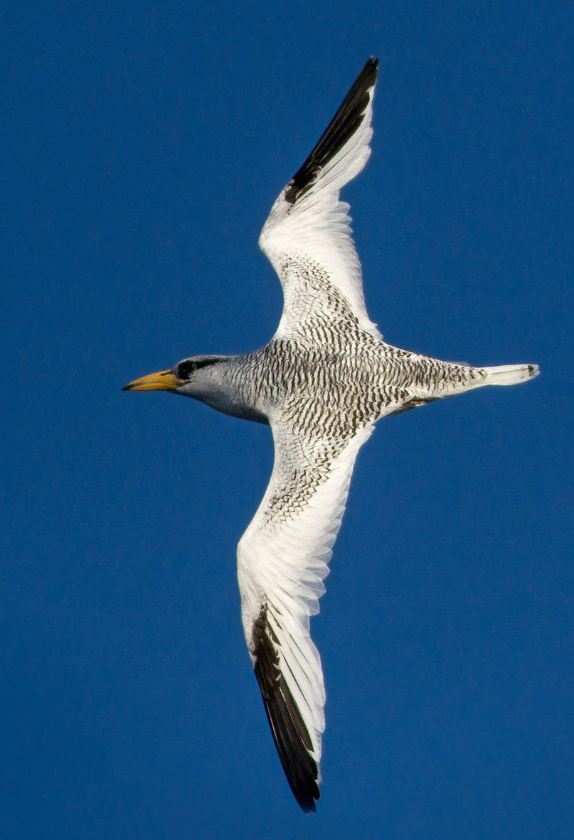
- Capped Petrel (or Black-capped Petrel), Band-rumped (Madeiran) Petrel (or Band-rumped Storm-Petrel), Red-billed Tropicbird, and Magnificent Frigatebird – Will these birds, also well-known for their occurrence in North American hurricanes make European appearances? Leach’s Petrels are sure to be common in this storm as well.
- What real European rarities might occur? Two candidates to be ready for include White-tailed Tropicbird and Audubon’s Shearwater. For the tropicbird, the recent haul from Hurricane Irene should have European birders hopeful. Joaquin passed right over Bermuda, a stronghold for White-tailed Tropicbirds. While they are less frequent in October, there are still plenty around–all it takes it one for a country first! For the shearwater, confirmation of the species identification may be the biggest challenge, but the storm has been crossing prime waters for the species that have been historically warm. For example, off coastal Massachusetts state record counts for the shearwater (and tropicbird!) were set this year in record high water temperatures. Here is one well-illustrated list.
Below is a hurricane birding primer that we have posted in the past on eBird so that birders can prepare for storms and plan their birding to get the most out of the storm. While Joaquin is unlikely to be as dangerous as many United States hurricanes have been, we still include the “Safety First” section in full. The allure of rare birds can be great, but we encourage everyone to be extremely cautious, heed local warnings, be especially careful about coastal flooding, and give this storm the respect it deserves.
HURRICANE BIRDING — AN eBIRD PRIMER
SAFETY FIRST !!!
To reiterate, remember that hurricanes and tropical storms are devastating and dangerous events. Driving in rain is bad enough, but driving in rain and hurricane force winds can be deadly. Avoid crossing bridges in high winds. Downed trees and powerlines, blowing debris, and other drivers only add to the peril.
Storm surge flooding is perhaps the most dangerous aspect of such storms. Since a surge of 15 ft or more can occur, many otherwise “safe” areas might be deadly in a hurricane. Do not take any chances with driving through flooded areas and do not do anything that might trap you in a low-lying area that is being flooded.
If you are considering looking for birds before or after the storm, make sure you are being safe during the storm’s passage. Don’t even consider intentionally putting yourself in the center of the strongest part of the storm.
SHELTER
Whether birding in the advancing storm or after the passage of the storm, you will need shelter from both wind and rain. If you plan any birding in the storm, think hard about what sites (overhangs on buildings, hotels with rooms facing a lake, river, or ocean, etc.) will provide shelter for you and your optics and not be facing directly into the expected wind direction. Birding from your car can sometimes be effective and safe, since an open car window facing away from the wind can be quite effective. Think in advance about how to use your telescope, either on a tripod or a window mount, from inside your car. Bring paper towels to dry off wet optics!
WEATHER
Understanding hurricanes is important. Hurricanes are cyclonic, so the winds are rotating counter-clockwise in the northern hemisphere. This means that northeast quadrant of an advancing storm will have winds from the southeast, and that those winds will shift to become southwesterly as the storm center passes to the west. This is important to understand since seabirds that do not like to fly over land may be ‘pinned’ against shorelines in the high winds of a hurricane. As the storm passes, you may want to shift your strategy, and be sure to consider shifting winds as you do so. Also remember that the northeastern quadrant of the storm has the strongest and most dangerous winds as well as the most rain. After the storm passes, conditions can quickly clear up and visibility can be excellent.
BIRDS IN THE STORM
One important general pattern is that the eastern sides of hurricanes tend to have higher loads of displaced birds than the western side. This could be because the tighter isobars here keep birds more effectively entrained within the storm. But note that in Hurricane Bob most rarities in New England were along the path of the eye.
Numerous reports also refer to birds being ‘trapped’ within the eye of storms, and many observers have seen large numbers of rarities in the calm eye of storms, although we would NEVER recommend intentionally putting yourself in the path of a hurricane with a well-defined eye (these tend to be stronger storms).
One consideration is how birds will behave in relation to obstructions. Most displaced birds will want to stay over water if possible, but tubenoses may be more closely tied to water than terns, for example. At a given reservoir a shearwater, storm-petrel, or even Pterodroma petrel is likely to stay for the day, maybe departing overnight. But terns, gulls, and shorebirds may depart if the weather allows; your exciting Sooty Tern may pick up and fly over the treeline and away. Note also that certain seabirds, especially boobies and gannets, shearwaters, and Pterodroma petrels, seem to avoid crossing bridges. There are several indications that birds like this may feel ‘trapped’ on a given side of a bridge. This could be a factor as you plan where to check for birds.

Leach’s Petrel—a classic hurricane bird!
Hurricane strength obviously has a bearing on how many birds are displaced, and roughly speaking, stronger storms carry more birds than weaker ones. However, strong hurricanes that dissipate to Tropical Storms can still carry birds long distances, ESPECIALLY if that dissipation occurs after the storm makes landfall. Storms that weaken to Tropical Storms while still at sea typically carry surprisingly few displaced seabirds.
SITES TO LOOK FOR BIRDS
Before the storm
An advancing hurricane will have a large front of winds blowing from the southeast in its northeast quadrant. If birding before the storm, pick a site where southeasterly winds will pin birds against the shoreline, or better yet, concentrate them in a bay or river mouth. Watch for storm birds flying from south to north with the winds at their backs. Often the local birds may be flying any which way, but the interesting storm birds will be heading up from the south fleeing the path of the encroaching storm. Sometimes rarities like Sooty Terns can fall out at inland lakes with the storm center still many hundreds of miles to the south. For example, Sooty Terns turned up at an inland lake in Maryland at 2pm on Friday, 6 September 1996, while the storm center of Hurricane Fran was still south of Cape Hatteras. It pays to get out and try, but do so safely and beware the storm surge and encroaching storm.
During the storm
Birds can be anywhere. Check any spot with water, especially rivers, large lakes, or inland bays. Even small lakes, ponds, or wet fields can generate exciting birds, especially shorebirds. If you can’t get to water, just look up. Some lucky birders have picked up Sooty Terns and other surprises right over city rooftops with no water in sight! Try to get a look at any grounded bird that a friend or relative reports to you and make contact with rehab centers that might receive and rehabilitate rare birds.
After the storm
It can often be difficult to connect with displaced seabirds after the passage of the storm. Check lakes for rare seabirds that may feel “trapped” on the lake until nightfall. Check rivers and coastal bays for birds reorienting back to saltwater, especially the eastern sides if westerly winds are ‘pinning’ birds to a given shoreline. Theoretically, there could be several days worth of commuting rare birds along major rivers.
Be alert for any sick, dead, or dying birds, since these could represent rarities. Check known shorebird spots, tern concentration spots, gull roosts, etc. to see if any rarities have stopped for a rest. Bays behind barrier islands can often trap seabirds just after a storm, and often the seabirds will also feel trapped by bridges. If there is a route back to the ocean, they may eventually find it, but many tubenoses (e.g., shearwaters and storm-petrels) might feel ‘stuck’ in a barrier island bay even if the ocean is just 200m away if they simply flew over the narrow strip of land.
Usually most rarities occur within a few hours or at most a day of the storm’s passage. Only on very rare occasion do species like Sooty Terns or tubenoses occur longer than 24 hours after a storms passage, and many seem to leave overnight. Very large lakes, especially the Great Lakes, can sometimes hold rarities for up to a week though, so be sure to get out birding as much as you can after a storm and see what is about. Frigatebirds in particular are famous for occurring well before and well after storm passage.
SPECIES TO WATCH FOR
Most of these species can be found at any season, although southern seabirds in general peak off the East Coast in late summer and early fall (when juveniles have dispersed and when waters are warmer). The few species with more significant seasonality are mentioned. In addition to the birds listed below. It certainly pays to check every bird carefully in storms. Some passerines, or highly aerial birds like swifts, could be displaced by storms as well. Check anything you see with care!
The below birds are ones with a history of showing up in odd places in clear association with Hurricanes and Tropical Storms.
SOUTHERN RARITIES
The following species are regularly transported up from the south by hurricanes:
Capped Petrel (or Black-capped Petrel) — One of the most often displaced tubenoses inland, in North America Black-capped Petrels have turned up on inland lakes and reservoirs many times. Interestingly, in true hurricanes they are probably more likely inland than species like Great or Cory’s Shearwater, which vastly outnumber Capped Petrel in nearshore waters off the U.S..

Capped Petrel (Black-capped Petrel)
Trindade Petrel — A long shot, but in North America, it has as turned up inland about 4 times and has turned up coastally at least a couple times in Virginia. To be watched for, especially since warm water in 2015 north to waters off Massachusetts could be good for the species.
Fea’s Petrel — Has turned up inland at least once in a storm, in Virginia in the epic Hurricane Fran of September 1996. Probably much more likely in Europe, especially if the storm takes a more southerly track. Bermuda Petrel has yet to be found in a storm, but is to be watched for.
Band-rumped Storm-Petrel — Along with Leach’s Petrel, Band-rumped Petrel has turned up inland numerous times in conjunction with hurricanes. The longer wings and more aerial behavior of the Oceanodroma storm-petrels may be part of the reason they outnumber Wilson’s inland, despite the fact that Wilson’s are much more common nearshore. Presumably, European Storm-Petrel would be scarce inland, relative to the two Oceanodroma.

Check any inland (storm-) petrel carefully for Band-rumped!
Brown Booby — This species has been exploding along the East Coast, with annual records now in areas where the species was known from only a handful of records prior to 2005. (See its eBird map here). Several records well up the East Coast in relation to storms. Masked Booby has almost never occurred well to the north in storms, but should be watched for. No confirmed inland records of either booby in relation to storms.
Tropicbirds — Both White-tailed and Red-billed Tropicbirds have been found in conjunction with hurricanes and Tropical Storms, although most often they have been found grounded inland and turned in to rehabilitators or found dead. Notable recent records of live, flying birds have come from the Chesapeake Bay Bridge-Tunnel (White-tailed) and Cape Cod (twice; White-tailed). Summer 2011 was one of the best tropicbird years ever, and Hurricane Irene carried a significant tropicbird load. A pelagic trip off Massachusetts found four in August 2015, adding to just seven or so previous state records, so 2015 was perhaps the best year ever for the species offshore.
Magnificent Frigatebird — Probably significantly more likely in June-August than later in the fall, although records of storm-displaced frigatebirds in North America extend to October and even November. Frigatebirds are famous for occurring well before a storm’s arrival and well afterwards, presumably because they’re so good in the air that they can easily soar on winds at the periphery to give the storm a wide berth. Watch for frigatebirds up to a day before the storm’s arrival and for up to a week after it has passed. Be alert for other species of frigatebird as well (i.e., always identify frigatebirds with great care)!
Sooty Tern — Probably the quintessential hurricane bird, Sooty Terns are highly aerial at sea and very likely to be displaced. Most storms that affect the East Coast of North America between August and October carry a good number of Sooty Terns. Look (and listen– “wide-awake”) for them at any body of water during or after the storm’s passage, or along coastlines where northeasterly winds may pin them to the coast. Watching a river or bay where seabirds may return to the sea may be the best strategy, and be alert for exhausted birds at any location or birds that join terns roosts. Many will be dark juveniles, which can be easily mistaken for noddies.
Bridled Tern — Generally speaking it is rarer than Sooty Tern in conjunction with storms, perhaps because it is overall less aerial than Sooty Tern and less apt to fly at great heights (where long-range displacement may occur). Much more likely to occur coastally than inland–inland records are especially rare and should be very carefully documented with respect to Sooty Tern. Previous storms have displaced large numbers to coastal locations (e.g., 130 at Chesapeake Bay Bridge-Tunnel, Virginia, in Hurricane Isabel 2003) and scattered birds coastally as far north as Maine and Atlantic Canada.

Although not as regular as Sooty Tern—there is still a chance to find a Bridled!
Brown Noddy — Just a couple records, all coastal, and many others of suspected noddies that either did not consider or did not eliminate juvenile Sooty Tern. While Brown Noddy is a species to be watched for, it is likely to be very very rare and incautious observers must take great care to eliminate juvenile Sooty Tern which is also all dark.
South Polar Skua — This is one to watch for. Although most have departed, this storm is not too late to bring one or a few to Europe.
COASTAL SPECIES
The below species are more typically coastal as compared to the more pelagic species listed above. Since Hurricane Joaquin hit coasts in the Bahamas, but not since, these species may be more scarce in this storm. Still, they are to be watched for!
Royal and Cabot’s Terns — Regularly pushed up from the south in storms. Much rarer inland, but to be watched for, especially in stronger storms. Obviously, Royal Terns in the storm could well pertain to American Royal Tern (Thalasseus maxima maxima) and Sandwich Terns should be checked carefully for features of Cabot’s Tern (Thalasseus [sandvicensis] acuflavida).
Black Skimmer — Rare north of Cape Cod, Massachusetts, hurricanes can often transport large numbers of skimmers north. Significant landfalls have occurred in Canada, so why not Europe? Unlike Sooty Terns and tubenoses, skimmers and certain other terns like Royal and Sandwich can often linger for many days or even weeks after hurricanes. For Joaquin though, the passage may not have been closoe enough to land to pick up highly coastal species like this. Still, be ready, just in case!
Least Tern — Almost never occurs inland except in hurricanes, but numbers can be swept inland in storms that occur before mid-September. Hurricane Joaquin may be a tad too late. If they can get swept inland, why not across the Atlantic? Separate from Little Tern with great caution (calls are helpful).
Forster’s Tern — Although this species is not very pelagic, it is migrating now in large numbers and might easily occur in this storm. Watch for it!

Check terns carefully—a Forster’s could be hiding behind their black mask.
Laughing Gull — Along the East Coast of the USA, displacement of gulls is relatively rare, but most species are regular inland. The one that is not regular inland–Laughing Gull–rarely seems to get moved inland by storms. But it is also fairly pelagic and might get swept up in this storm. Other gulls should be watched for too, including especially Bonaparte’s and American Herring Gull (Larus argentatus smithsonianus).
Wish list birds — White-faced Storm-Petrel is still prevalent in the waters traversed by this storm and might get blown close to shore. A few North American records do show that species getting moved around by storms. Bermuda Petrel, Black-bellied Storm-Petrel, Bulwer’s Petrel (has occurred once in a storm in North America, at Virginia’s Chesapeake Bay Bridge-Tunnel), and albatrosses (at least one Yellow-nosed occurred on the Hudson River, New York in a storm) are all to be watched for as well!
LANDBIRDS
Past hurricanes have brought large numbers of Chimney Swifts across the Atlantic. This and other landbirds are to be watched for. Although migration was not good during the passage of the storm, the Eastern USA saw good migrations on 5 and 6 October, and those movements could have resulted in over-Atlantic migrants like Blackpoll Warbler, Bobolink, cuckoos, and others getting swept up in Joaquin‘s wind field. If so, the list of potentially interesting birds is even longer!
INLAND RARITIES
If the storm is strong enough, watch for typical coastal seabirds (including Cory’s, Manx, and Sooty Shearwaters, Northern Fulmar, and Leach’s Petrel among others) could get swept inland. Watch for these and other birds inland during or after the storm. A few notes on select species are below.
Cory’s Shearwater — In North America this is perhaps the most regular shearwater inland.
Northern Fulmar — As a northern species, it is not usually a feature in North American hurricanes. But they are susceptible to weather, and might be more common in Europe during this storm.
Leach’s Petrel — The most likely petrel (storm-petrel) inland, although storms coming up from the south could likely have Band-rumped Petrels too. As the season gets later, Leach’s becomes the more likely storm-petrel, since Wilson’s becomes quite rare by October. Some of the larger fallouts of Leach’s have been in October and November.
Wilson’s Petrel — Shockingly rare inland, with literally only a handful of confirmed records in North America (as compared to many hundreds of Leach’s and about 5-10 Band-rumped), including Cayuga Lake, near Cornell University, Lake Erie, and inland lakes in North Carolina. Records should be carefully documented, since either Leach’s or Band-rumped is much more likely, and both can be very similar, especially in the high winds and poor viewing conditions of hurricanes. Please use storm-petrel sp. if you are unsure of the species.
White-faced Storm-Petrel — One of the holy grail birds of a hurricane. It has occurred inland on Jordan Lake, NC, and the James River, VA (both Hurricane Fran 1996), as well as in Connecticut.

If you’re lucky, hurricane birding could yield something as fantastic as a White-faced Storm-Petrel.
American Oystercatcher — A long shot to watch for.
Shorebirds — Almost any species of shorebird can turn up inland in storms, including Red Knots, Whimbrels, and other species that aren’t often seen inland.
Parasitic, Pomarine, and Long-tailed Skuas (Jaegers) — Some may represent overland migrant birds ‘grounded’ by the storm. As always, take great care with jaeger identification.
Arctic Tern — Most Arctic Terns have already migrated south by late August, and most migrate well east of the tracks of hurricanes, so they tend not to occur often in storms. Still, it is to be watched for, especially in August and September.
Alcids — Given their rarity in southern waters during the summer, alcids do not generally occur inland or coastal in hurricanes, although easterly winds can push them to shore. Hurricane force winds in winter can cause large wrecks of alcids inland though, including Dovekie and Thick-billed Murre in particular.
HURRICANES OF THE PAST
HURRICANE BOB
One of the better recent storms for rare-bird fallout in New England was Hurricane Bob. You can see its track here: http://www.stormpulse.com/hurricane-bob-1991. It was a fast moving storm (30 mph when off the mid-Atlantic and New England) and made landfall in Rhode Island at 2pm on 19 August 1991. It cross Massachusetts east of Boston and west of Cape Cod, and was in Cumberland County, Maine, by 8pm on 19 August. Birders were mobilized as the storm passed and had the following results:
North American Birds summarizes the storm in its articles available here. A few highlights:
- Black-capped Petrel at Wakefield, RI, 19 Aug
- White-tailed Tropicbird found dead in Eastham, MA, 22 Aug
- Bridled Terns in Maine (1; first for state) and Connecticut (2); Sooty Terns in Connecticut (1) and Rhode Island (2); about two dozen Sandwich and 65 Royal Terns in all three states (Rhode Island had 16 Sandwich and 38 Royal, the one Sandwich in Connecticut was a state first); and 300+ Black Skimmers in Rhode Island
HURRICANE FRAN
Hurricane Fran made landfall near the North/South Carolina border on the evening of 5 September 1996 with 10 mph winds. It dissipated from there as it headed inland, but it became known as one of the best hurricanes on record for rare birds. Ned Brinkley, Todd Hass, and Brian Patterson summarized the storm (as well as Hurricane Bertha) and what was learned of birds.
- The most productive birding was at Kerr Reservoir in southeastern Virginia, see the list here which includes Fea’s and Herald Petrels, Sabine’s Gull, and much much more!
- Dozens of Black-capped Petrels inland in Maryland (first confirmed record), Pennsylvania, and even on Lake Ontario!
- Pennsylvania’s first Cory’s Shearwater at Williamsport.
- Inland White-faced Storm-Petrels at Jordan Lake, NC, and the James River, VA!
- American Oystercatcher north to Lake Ontario, for a fourth provincial record!
- Many seabirds at Falls Lake and Jordan Lake, NC, including Sooty Shearwater, Leach’s Storm-Petrel, and Audubon’s Shearwater
- Wilson’s Storm-Petrels one Jordan Lake, NC, and up on Lake Erie!
- 50-100 Sooty Terns scattered from the Carolinas to Pennsylvania to Ft. Erie, Ontario. Some remained as late at 10 September on Lake Ontario. Others were seen coastally after the storm’s passage at Cape May, NJ, and other coastal sites.
HURRICANE IRENE
HURRICANE SANDY
eBIRDING THE STORM
When seawatching, or providing data for any long stationary count, it can often be helpful to break those counts into hourly units. Since there is still much to be learned about how and where birds occur in such storms, having hourly total information would be quite helpful. Including notes on behavior and age (when known) of birds seen, especially if they seem to be species displaced by the storm. Do not ignore commoner species like gulls and terns since some of those species may have been displaced by the storm too. And, as always, please be conservative with your identifications (i.e., use tern sp., storm-petrel sp., shearwater sp., or tropicbird sp. (!) if needed) and document rarities to the best of your ability.
While displaced seabirds and other rarities are of course exciting, it is worth remembering that these storms are major disruptions to fall migration and can cause devastating mortality to birds. Even observations of typical landbirds before and after a hurricane have value, so please do get out birding even if you aren’t in a spot likely to get rare storm birds.
As a nice note of hope, note that this satellite-tagged Whimbrel survived a migration right through the storm!
Be safe, and good luck!
REFERENCES
Check out these hurricane submissions from eBirders!
- Brian Sullivan and Ned Brinkley, Kerr Reservoir, VA, Hurricane Fran 1996
- Ned Brinkley and Brian Sullivan, Chesapeake Bay Bridge-Tunnel, Hurricane Isabel 2003
- Marshall Iliff, Ocean City Inlet, MD, one-hour period during Hurricane Hannah 1998
- We welcome others! Just send the observation report link to mji26 AT cornell.edu
This is one of the seminal articles on hurricanes, discussing the active and exciting season of 1996.
BRINKLEY, E. S., T. HASS, AND J. LOCKYER. 1997. The storms of 96, Part 1: the storms and their associated birds. Audubon Society Field Notes 51: 819–829.
See also:
Hurricane Bob — seasonal report from American Birds available here.