


Maps.Me
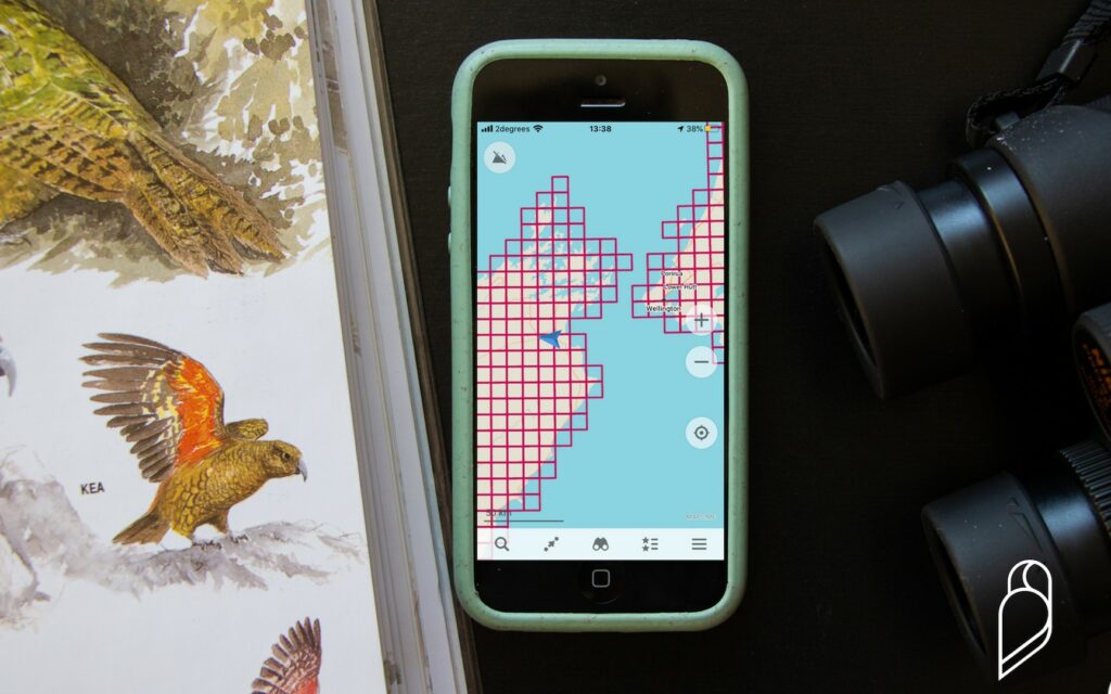
The eBird app now has the functionality to display the New Zealand Bird Atlas grid when you are entering a checklist. However, it is also possible to view the New Zealand Bird Atlas grid on an interactive map on your phone, using the Maps.Me mapping app, even without cellular service! With this in mind, Maps.Me provides a valuable service to you as an Atlas participant. The app not only helps you locate yourself within a grid square and see where you are in relation to adjacent grid square boundaries, even whilst out of cellular service, using your device’s GPS. It also helps with Atlas trip planning as it contains heaps of walking tracks and elevation information for tramps. This means you don’t have to start a checklist just to see where you are in relation to the grid or indeed plan your Atlasing!
Maps.Me is a free mapping app that can be downloaded from your device’s app store on both Apple and Android devices.
Installing:
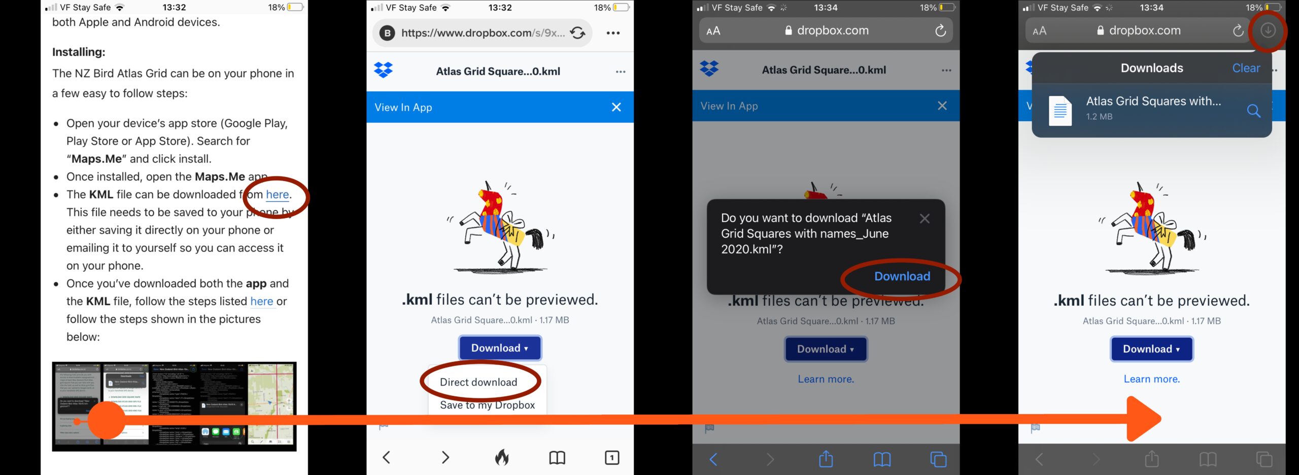
The NZ Bird Atlas Grid can be on your phone in a few easy to follow steps:
- Open your device’s app store (Google Play, Play Store or App Store). Search for “Maps.Me” and click install.
- Once installed, open the Maps.Me app.
- The KML file can be downloaded from here. This file needs to be saved to your phone by either saving it directly on your phone or emailing it to yourself so you can access it on your phone.
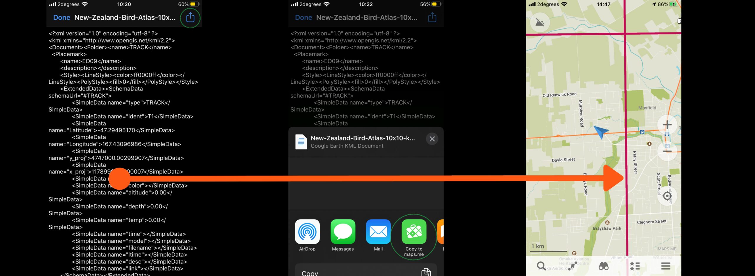
- Once you’ve downloaded both the app and the KML file, follow the steps listed here or follow the steps shown in the pictures below by clicking on the images to make them larger (currently iOS – Android screenshots to come):
We’ve been using this app a lot when out Atlasing and during fieldwork, often in areas with very patchy or no cellular service and have loved it. We hope it becomes a useful tool for you all on your Atlasing adventures.
NEW Seasonal KML Files
KML files are now available to show season points for Winter, Spring, Summer, and Autumn. You can also download the Year Round points too, but bear in mind this is a larger file! These can be imported into Maps.Me, Google Earth or any other mapping programme to then focus your Atlasing effort more to areas not surveyed. If using this, we strongly encourage this to be used in tandem as a supporting tool with the Atlas Effort Map! Remember, just because someone has gone somewhere doesn’t necessarily mean they’ve detected all the possible species, so it is still worth going back to places to gather more observations.
Stay safe and have fun out there!